There is a way forward. For distance and bearing calculations, using the site database, producing a listing for any specific site,
use the new windows programme SitecalcWin.zip.
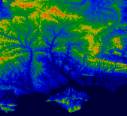
GEOG2.ZIP
Terrain plotting and locator conversion software. Runs under DOS/Command Prompt. You will also need the Height database itself :-
HEIGHTS2.ZIP
which gives ground height above sea-level within the UK on a 500 metre grid based on NGR. Both files are needed.
The source code is here
GEOSOURC.ZIP
and includes all the NGR / lat-long conversion maths. Also mouse control and graphics from pre-windows days.
Written in PowerBasic (16 bit for DOS)
NEWLOCTN.ZIP
A new Version of LOCATION with conversion to / from Natural Area Code (NAC) see
www.nacgeo.com/nacsite/
for details
This is a very old suite of programmes, originally written in the 1990's purely for 16 bit DOS applications. For a long
time most ran in all versions of Windows, in a command prompt, with varying levels of success. The advent of Win 7 has now stopped this. It
is still possible to run them using DOSBOX, but that ends up very slow and inefficient.
For heights, profiles, path plotting and propagation calculations, use G0MJW's software which makes use of the higher resolution
SRTM or ASTER worldwide height databases
Download Here
BUT if, after all that you still want the old DOS based stuff, here it is: